Photo by Chris Cruz Dream Lake Wetlands Lassen Volcanic National Park
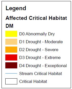
This map shows the areas of critical habitat in California that have been impacted by the drought over a ten year span, from 2006 to 2016. This was achieved by obtaining drought data from the United States Drought Monitor and critical habitat data from the United States Fish and Wildlife Service. With these resources, we were able to create an animation that shows the progress of the drought through areas of critical habitat over time. The larger legend below goes with the video.
|

|
